Wednesday, March 30, 2016

Big South Fork

There are National Parks that get crowded during spring and summer vacation, the most popular sights overrun with trekking poles, go pros and plastic water bottles. Then there are those massive swaths of public lands that are relatively empty – even the Visitor Center parking lot vacant in the early light of dawn – and I wonder what is it that keeps the droves away, as it’s surely not a lack of recreational opportunities & natural sights… These are the places to visit during early spring, for example avoiding the vehicle queues and smog in the Great Smoky Mountains NP and opting instead for the stunning scenery of the Cumberland Plateau and Big South Fork National River and Recreation Area.


It was an hour’s drive from Caryville to Big South Fork, some 45 miles through the scenic TN countryside to reach the Visitor Center at Bandy Creek. We turned west at Oneida, entering the National River and Recreation Area (NRRA) on Leatherwood Ford Road. First a quick 0.8 mile hike (there and back) to the East Rim Overlook, the perfect introduction to the striking scale of this massive valley. The clouds hadn’t yet burnt off, and the view of the river and bare hardwood valley walls was partially obscured even as the boys exclaimed over the cold and begged to retreat to the car. We obliged, but only after passing around the binoculars to see if we couldn’t get a look at the John Muir Trail which during this section runs parallel to Big South Fork of the Cumberland River.


One of the primary recreational opportunities here is on the water. 90 miles of scenic river gorges, cliffs and valleys with colorfully-named rapids such as the “Washing Machine,” “Jake’s Hole” and “First Drop” provide whitewater for the beginner to the experienced in all seasons. Chris Arp (a local paddler from Knoxville) has filmed several of his trips; view the clips of Double Falls Rapids here, Washing Machine here and The Ell here. Together these rapids are referred to as "The Big Three". The class I – IV rapids on Big South Fork and its tributaries Clear Fork, North White Oak and New River definitely offer a challenge – albeit one that I cannot accept until the kids are old enough to hold their own paddle.


There are only two bridges across the Big South Fork in the park (another three on the south end over Clear Fork and New River before they join to become the Big South Fork), the river effectively bisecting the Park in two and restricting travel from east to west. Leatherwood Ford Road descends swiftly to the river through a series of switchbacks, climbing the other side in tight curves. It’s no wonder the next crossing is miles to the north in a completely different state – the Yamacraw Bridge also being the gap where the Big South Fork Scenic Railway crosses the river. The seasonal Stearns Depot Visitors Center is also up on the north end, although we opted to stop at the Bandy Creek Visitor 
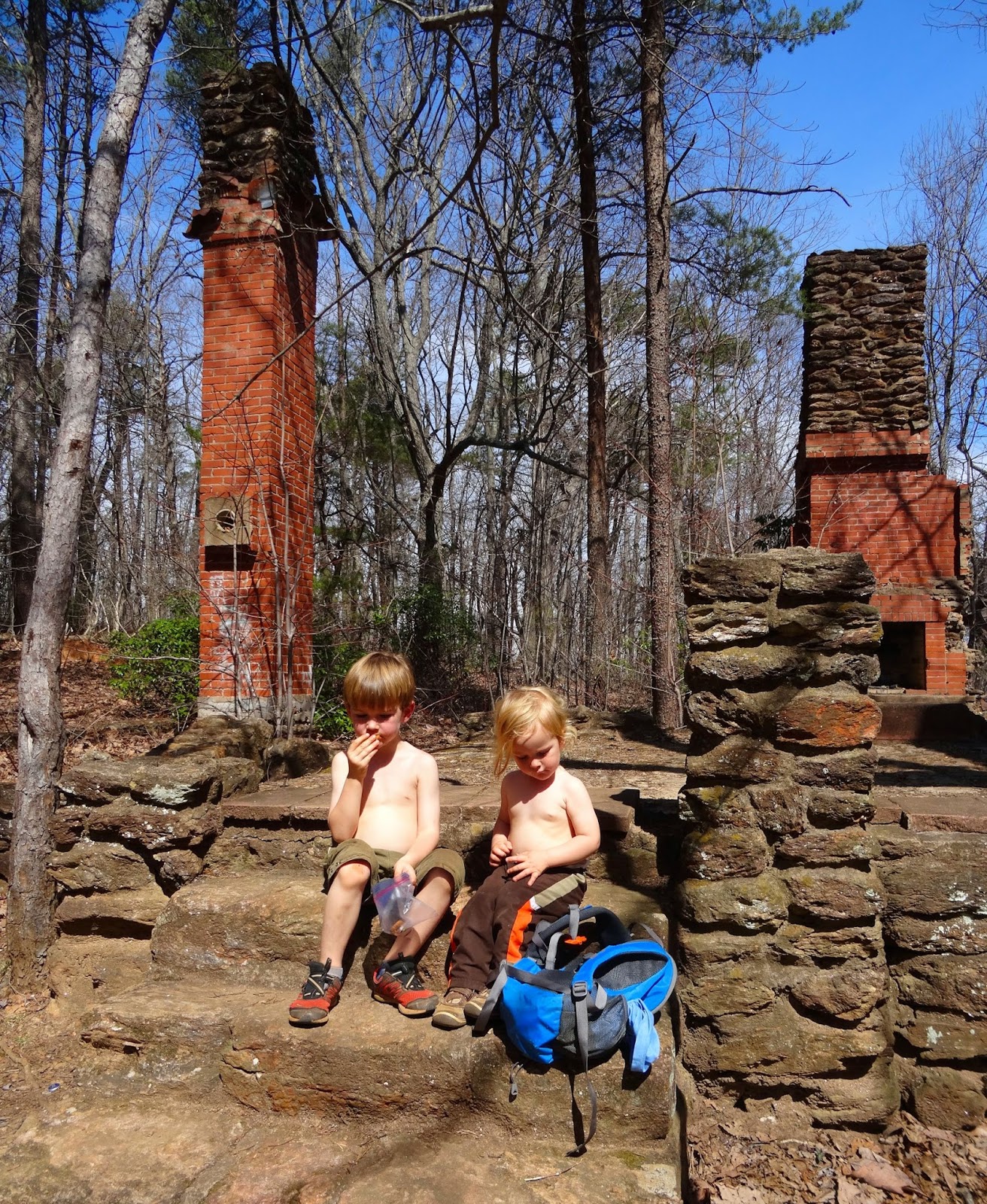
Center in the center of the park as it is open the whole year. We double-checked our trail selections, picked up a couple of Junior Ranger brochures, and headed further west.

hiking across the top of North Arch

It took almost a full 30 minutes to reach the Twin Arches trailhead, located just east of Pickett State Park on the Hatfield Ridge. The 1.4-mile upper loop is rated easy/moderate and travels from the trailhead to the Twin Arches, the largest natural bridge in the state of Tennessee and Kentucky and the largest sandstone arch complex in the East. From the arches the lower loop continues for a 4.6-mile hike rated difficult, the trail leading to a spectacular series of rock houses, cliffs, Jake’s place (old home site) and Charit Creek Lodge, but we were content with our shorter loop, especially as it took us over the northern arch before descending to the base of the formations where we were free to explore.

North Arch

The North Arch spans 93 feet and is 62 feet tall with a clearance of 51 feet. South Arch is 103 feet tall, spans 135 feet and has a clearance of 70 feet. By comparison, the record-holders in Arches National Park: Landscape Arch at 306 feet across and Double Arch South with a 112 feet clearance.


The boys found a cave in the South Arch that cut all the way through, and they spent some time climbing the boulders around the base of both arches before discovering the football that had been packed in one of their backpacks. We could have easily spent another hour enjoying this spectacular natural wonder…

South Arch

Big South Fork offers hundreds of miles of trails on its 125,000 acres, and not just for hikers but for horses and mountain bikes as well. This is a relatively new park, authorized by Congress in 1974 and the first of its kind (a national river and a national recreation area), but the scenery is timeless. From the 600-foot deep gorge to the dozens of overlooks & waterfalls, this is some of the wildest and most rugged territory on the Cumberland Plateau.

labeled 'steep stairs' on the map

Having retraced our steps all the way back to Oneida we turned north, crossing into Kentucky near the road that could take us to Yahoo Falls, the highest in the state at 113 ft. We ran out of stamina, the steep stairs of the Twin Arches loop having sapped the strength from those with shorter legs, and so we bypassed Yahoo and instead turned east towards Cumberland Falls State Resort Park. I had been wondering where the crowds were – turns out they were here at the falls, the “Niagara of the South.” 

Cumberland Falls

The State Park was such a stark contrast to Big South Fork in all aspects, not just the crowds: poor signage, overflowing parking lots, visitors ignoring warnings to stay out of dangerous areas above and below the falls, and an unbelievable volume of trash. It was all I could do to not turn around and head back to Big South Fork…

above Cumberland Falls

Monday, March 28, 2016

The elusive Oconee Bell wildflower

The sides of the streambed are blanketed in waxy, red-tinged leaves, small white flowers visible only upon a closer look. Had we not traveled to Devils Fork State Park specifically to see this delicate wildflower, we might have hiked right past the colonies of this rare plant without a second glance.


The Oconee Bell is only found in a few locations in the southern Appalachians, in moist, wooded areas along the streams of Georgia, North and South Carolina. The tiny flowers are one of the first to bloom in the Upstate – from mid-March to early April – and attract quite the crowd to this state park better known for summer swimming and camping.


One of the park staff said “we had a brochure in the holder by the trailhead. Usually folks finish the trail and put them right back. Last weekend cleaned us right out, there were at least a hundred; I’m going to have to print more.”


The flower has a very limited range in the wild even though it can be purchased commercially and grows well in gardens, and therefore the appearance of the native wildflower is cause for celebration. Every year Devils Fork puts on the Oconee Bell Nature Walk, this year the event falling near the beginning of the bloom on March 17th. If you missed the walk, you still have time to catch the Oconee Bell blooming; the ranger predicted the plant will be hitting peak bloom this week, and the Oconee Bell Nature Trail takes you along a dozen colonies of this unique wildflower.


The trail is an easy 1-mile loop that takes hikers through the oak-hickory forest, past a small pond and alongside the creek that is home to the elusive wildflower that gives the trail its name. In addition to the Oconee Bell, dozens of other plants and trees are identified by wooden markers, and several small cascades on the creek add to the list of attractions available year-long.


If you’re headed to Devils Fork to hike the Oconee Bell trail you just follow signs to Ranger Station. A quick stop there for a map or restrooms, and then it’s just a matter of crossing to the other side of the parking lot to the trailhead. The parking lot is on the southeast corner of Lake Jocassee, and the scenic views of the lake, Double Springs Island, and the swimming and picnic area on the southwest shore are stunning. Bring a picnic to eat on the lake, or upon finishing your hike circle around to Buckeye Drive where you will find picnic shelters and a playground.


But in any case, make sure you practice what the Park Naturalist terms “belly botany” – get an up close look at the low-lying flowers by getting close to the ground. There are several locations were the colonies are close to the trail, and so it was relatively easy for all the kids (and adults) in our group to get a good look at the Bell. Though it is important to remember, for your safety and the protection of the bells, to please stay on the trail.

The 2011 stamp celebrating the Oconee Bell and botanist Asa Gray

Devils Fork State Park website here

Map of Devils Fork SP trails here 
My previous post on the park here
Exploring Lake Jocassee and its many waterfalls by boat here
A post on the other end of Lake Jocassee and Jumping Off Rock here

Friday, March 25, 2016

Happy Easter!


May your eggs dye dark brown,
may your paska be white as snow,
may you find the hidden eggs you are looking for,
whether they be high or they be low.


May the Easter bunny find your yard,
and may you have strength to tolerate the sugar crash after,
may your swings carry you high into the sky
and may your Easter be full of joy and children’s laughter.


x Femme au Foyer

Wednesday, March 16, 2016

Paris Mountain's fire tower

There are three different ways to access the Fire Tower trail in Paris Mountain State Park. Your first option is to take the Sulphur Springs trail from Mountain Lake, and there’s also a connector linking it to Kanuga trail; however, the easiest and shortest choice is to take Sulphur Springs from the upper parking area where the Brissy Ridge loop departs. (For the Paris Mountain State Park trail map click here)

  
The section of Sulphur Springs from the kiosk to its intersection with Fire Tower is somewhere about 1.3 miles, while Fire Tower is 0.4 miles one way, making the there-and-back hike a total of about 3.4 miles. It would be a whole lot shorter, but instead of crossing the Mountain Lake drainage it skirts around the various side-tributaries, making for a slightly longer, but less strenuous hike. As the trees haven’t leafed out yet there were some nice views to the Southwest, and exposed rock jutting out to the ridge side provided contrast to panoramas over the predominantly hardwoods draw.


At its intersection with the Fire Tower trail, Sulphur Springs cuts south in a steep descent into the drainage, following the creek to Mountain Lake. Meanwhile the Fire Tower trail turns north, ascending 400 feet in elevation along an old road bed. You see the private homes before you see the ruins of the old fire tower house, as this is the very west boundary of Paris Mountain State Park.


What is today only a foundation and a couple of chimneys was once a four-room house, well, barn, smokehouse, chicken coop and outhouse, along with an 84-ft steel fire tower. Built by the Civilian Conservation Corps in 1938, the site was abandoned only five years later when the tower was moved to a spot at a higher elevation. Although there are fantastic views to the west, the mountain blocks a 360˚ view – not the case in the Tower Road location.


That fire tower has since been decommissioned; for more on the Paris Mountain summit and the Altmont Hotel that once stood there, here are two articles on the subject…


It was turning into a rather warm March day, and running dangerously low on snacks and energy we headed back the way we came. It took us (two moms, a 4 year old, a 3 year old and a 1 year old riding in a backpack harness) a total of 2.5 hours to hike there and back, allowing for frequent stops to explore, examine objects found on the trail, and to snack. I would have liked to spend additional time at the summit, exploring the ruins and taking in the view, and the last ½ mile was slightly hurried – next time I will budget closer to 3 hours for the round trip. 

Monday, March 14, 2016

Lava lamp science experiment

My sister had a lava lamp when we were kids. There’s something about the colors and the wax bubbles that is fascinating to watch! I’m not sure I want a real lava lamp in the boys’ room due to the potential disaster if it were to get knocked over, however we discovered a neat alternative a few months ago while conducting science experiments with friends.


To create your own lava lamp you’ll need:
- A clear glass bottle
- 3/4 cup of water
- vegetable Oil
- food coloring
- Alka Seltzer tablets


Pour the water into the bottle. We prefer glass over a plastic soda bottle because although you have to be more careful with the glass bottle, an accidental squeeze with the plastic bottle means a big, oily mess! Add 10 drops of food coloring to the bottle, and swirl to mix with the water. Using a funnel fill the bottle with vegetable oil; it should be almost full. And just like that, you’re ready for lava lamp action! Break an Alka Seltzer tablet in half and drop into the bottle – as soon as it hits the water it will start bubbling!


Here’s what’s happening:
Oil and water do not mix because water molecules cannot bond with oil molecules (intermolecular polarity). Also, water is denser than oil, and so it settles to the bottom. The tablet doesn’t react with oil, but when it sinks to the bottom it starts dissolving, creating gas bubbles. These bubbles are lighter than water and oil, and when they rise to the top they take some colored water with them. Upon reaching the surface the gas escapes, and the water then sinks back down through the oil.


For the lava lamp effect, shine a flashlight through the bottom of the bottle – super cool!


Remember to store your lava lamp with the cap on, but leave it off while there is still gas escaping. Waiting 10 minutes will allow the oil and water to completely separate out, and then you can start again with another tablet!

Wednesday, March 9, 2016

FLOTUS in the garden!

The First Lady has made it a priority to leave a garden-to-table, healthy-foods-in-the-schools legacy. The “Let’s Move” initiative, which started with the 1,100 square foot vegetable garden on the South Lawn, originally developed when Mrs. Obama realized her daughters Malia and Sasha were not eating rounded meals (a lot of eating out and snacking). The garden now produces more than 55 varieties of vegetables that are not only incorporated into White House meals, but also donated to the local soup kitchen and food bank.

source: here

A White House garden is by no means a novel idea: the second President John Adams (and First Lady Abigail) planted the first White House garden in 1800, Roosevelt planted a victory garden during WWII to promote the use of gardens by American citizens in a time of possible food scarcity, and most recently Hillary Clinton utilized the roof of the White House for a vegetable garden. However our FLOTUS is taking the next step and taking to the road, kicking off a garden tour initiative in her last year in the White House.

source: here

Mrs. Obama announced last week that she will travel around the US to gardens, schools and other spaces to help share the stories of local gardens. To kick off this tour she visited a local DC garden that might seem a tad familiar… because you saw it last spring when we toured Ēriks and Linda’s Urban Farm Plans!


In addition to this White House video make sure to watch the video that appeared on the Today show (which also included a surprise visit to two DC-area schools) to see Michelle Obama announce the initiative. You can also follow along on her garden journey through the Instagram account @WHKitchenGarden, and here is the Urban Farm Plans website. Finally, the original post on their backyard garden, The Modern Face of Urban Gardening.


Monday, March 7, 2016

A new vegetable garden with DIY edging

Our backyard garden is constantly a work in progress. The first year after moving in was a whirlwind, as we built raised beds, planted berry bushes and installed a gently-used playground for the boys. Although the progress has slowed, there have still been noticeable additions including the mud kitchen with a mosaic for the kids – a great success. However it was last year around this time that we tackled a larger project that had been causing me grief; we successfully installed a new garden bed along the side of the house.


Every spring I experimented with and quickly lost a succession of seedlings in this strip, mostly due to the heat reflecting off the brick and the woodchips doing a poor job of conserving water. What survived the spring sun was lost to squirrels and curious toddlers. In addition to the lack of functionality, this was neither an  attractive area of the garden, nor were we happy with the insects that were moving into the woodchips. In its place I envisioned a bed of hostas complimented by seasonal flowers, and after taking measurements, we purchased concrete edgers similar to these ones and got to work.


The first step was marking off the area that would be included in the new bed and removing the turf & woodchips. The edgers are round on one end, and so the bed doesn’t have to be square as they can easily be arranged in a curve. We started by placing the stones down (but not settling them in), to verify that we had the correct quantity and also to be able to visualize how the finished bed would look. This also enabled us to make adjustments to the original plan while the stones were easily movable. Then, utilizing a board cut specifically to the selected width of the bed (to guarantee that each stone would be the same distance from the house), we settled the edgers into place, making sure they were all aligned and even.


A load of soil was the next step. The removal of the topsoil created an edge on the turf side, and the added soil serves to hold the edgers in place on the opposite side as well as providing the nutrients needed for healthy plants. Using river stones I created a spot under the faucets to coil the hose (so there wouldn’t be an endless mud pit), and downspouts were incorporated in such a way as so to not wash away any plants or topsoil.


The then comes the fun part: selecting plants and planting them! My initial vision had been for hostas with a seasonal rotation of flowers to add some color along the house. However, I quickly realized that utilizing the sunniest portions of the new bed could possibly triple the space in our garden for growing vegetables, and so it was quickly filled by my sons with tomatoes, squash, cucumbers and watermelon. Sunflowers provided color in the rear, and marigold protection against insects in places along the pavers. A narrow section along the very end of the bed has proved ideal for strawberries, and the pallet planter was relocated to add a vertical aspect to the bed (and guarantee more strawberries!).


There is a section of the new bed that is more shaded and has ended up somewhat resembling my initial vision. Fillied with perennials and forming more of a flower bed, this is the area that contains hostas alongside some irises my wonderful neighbor divided for me. Over the winter we tucked in pansies for color, and with the warm weather we’ve had recently I noticed the canna lilies that were somewhat an experiment in overwintering are actually coming up. I also have this tendency to rescue mums that are no longer wanted after having lost their autumn color, and so there is already a smattering of green joining the strawberries that survived the cold temperatures. However, there is also plenty of bare soil on the other end of the bed… our last frost might still be a month off, but we’ve already started our seeds indoors and are dreaming of the tomatoes, peppers and vegetables we’ll be soon harvesting!

Friday, March 4, 2016

A Splendid Savage

From the author of A Labyrinth of Kingdoms: 10,000 Miles Through Islamic Africa comes the biography of Frederick Russel Burnham, frontiersmen, scout, prospector, husband and father. Steve Kemper has received high acclaim for his portrayal of the explorer in his novel A Splendid Savage: The Restless Life of Frederick Russell Burnham, including reviews by the “Wall Street Journal” and “Outside Online,” where the article “Frederick Russell Burnham Is the Most Interesting Man in the World” was the beginning of my journey around the world with the famous scout.


From his adventures in the American West during the settling of the frontier and the Gold Rush, his search for Montezuma, to his role in the events that unfolded in South Africa at the turn of the century, the nonfiction book reads like an action thriller. Full of daredevil stunts literally the stuff of stories, the book was a surprising page-turner for me considering I don’t often read biographies.

Source: here

While Burnham is famous as “the great American scout” for his in regards to his extensive knowledge of tracking and woodcraft, I found it fascinating to read about the roots of his outdoor skillset which were learned studying (and later tracking) the Apaches in Arizona while he was still a teenager. With the uncanny ability to apply his knowledge to environments from the deserts of the American West to the African veldt, Burnham was just at home in the Klondike as he was in Mexico in the early 1900s… and high-society London!

Burnham and his 1910 discovery, the Esperanza Stone (source: here)

A list of the scout’s influences and acquaintances features Presidents Wiliam Howard Taft and Teddy Roosevelt, to some of the wealthiest men of the time including the Guggenheim brothers and Cecil Rhodes. His expertise motivated friend Robert Baden-Powell to found the Boy Scouts, and inspired Roosevelt’s initiative “the Rough Riders.” Meanwhile his accomplishments read like a highlight reel of a history book: protecting President William Howard Taft from a possible assassination, discovering and marking hundreds of gold, silver, coal and other mines, more than 100 behind-enemy-lines scouting trips during the Boer Wars and finally striking it rich with the discovery of oil in California. He even had an archnemesis – the Boer scout and German WWI spy, Duquesne.

Cover of Burnham's novel "Scouting on Two Continents" with illustration by Baden-Powell

Burnham was a series of contradictions in his attitudes and actions regarding race, politics, nature and family. Kemper does a great job of delving into the motivations behind the racism of the day yet giving an honest account of the scout’s deeds (and misdeeds). Incredibly relevant in today’s world of religious and racial division, the author provided valuable insight into the controversial colonialism of the time. And yet we are taken on sidetracks such as the U.S. Army Camel Corps, and the movement to introduce indigenous-African animals including bushbucks, klipspringers, springboks, dik-diks and duikers (and some more familiar ones such as zebras and hippos) to the American tableau. Finally we gain a window into Burnham’s relationship with his wife Blanche, surviving even the loss of two of their three children and the scouts relentless wanderlust.

Burnham and his wife Blanche at their CA ranch near Sequoia NP

This book appealed to me on several levels, and was disappointing in none. The theme of scouting, the persistent education on world history and the adventure of a lifetime – if you wish to read one non-fiction book this year, I heartily recommend “A Splendid Savage.” 

Wednesday, March 2, 2016

A regatta in downtown Greenville

What to do on a sunny winter day? Maybe an origami boat regatta?


We joined friends downtown at ONE City Plaza, the newly redesigned public space that houses a water feature running the length of the square. With large ‘steps’ on one side intended as seating (an ‘urban couch’ according to design firm Civitas) and landscaping on the other, the water is easily reachable and allows for safe exploration.


We spent a few minutes looking at videos of how to make origami boats while Vilis napped, and having crafted a few different styles out of a variety of materials (newsprint, printer paper, watercolor paper, aluminum foil, wax paper), we decorated our regatta with colorful designs and flags. After throwing a few plastic boats into the mix we headed to pick up Lauris from school and let him in on the plan.


The wind was strong, sinking more than one newsprint boat on its maiden voyage. The wax paper boat joined the underwater salvage yard. All safety precautions were taken to ensure the LEGO figurines would not come to harm. Luckily the plastic boats endured, as then Vilis had a boat to pilot.


We discovered the aluminum foil and watercolor paper boats to be the most successful, the former more so when weighted down with a few coins or rocks to counteract the wind. I had hoped the water would get soaked up into the watercolor paper and make a spectrum out of the colors we had drawn at the bottom with markers, but because of the wind it was just washed off. Paper airplanes joined the mix, as sleeves, shoes and knees got progressively wetter. Nevertheless, it was clear that the afternoon activity was a winner – good friends, running water and toys, what else do you need on a sunny afternoon?


The more experienced regatta moms came prepared with extra paper for the kids to experiment with their own designs, and paper clips & coins to add strategic weights and balance. I have a few more ideas I want to try on our next visit, and hopefully the wind will not be as strong and the temperatures warmer… Any regatta tips for me out there?


A little more on ONE City Plaza…

It was on the corner of Main and Washington that four young black men staged a sit-in at the Woolworth’s counter in 1960. The building is gone, but this block is still the heart of downtown Greenville. When revitalization was first initiated in the 1980’s, the space was called Piazza Bergamo (after Greenville’s sister city), and over the next 25 years it was a hub for outdoor concerts and events. Along with the new construction (which has attracted businesses such as Anthropologie, Brooks Brothers and the hotel Aloft), the piazza was also redesigned. Completed in 2013, the $5 million project is “themed from the history of the region as a place of weaving. Layers and folds of patterns, a long fountain and urban couch form that spine that attracts people to engage and relax.” (source here) I'm happy that the Mice on Main statue remains a resident, but look forward to seeing the trees planted to give the space some shade from the summer sun!

Related Posts Plugin for WordPress, Blogger...